Call Us Today 973-529-4973 Email Us: [email protected]
Call Us: 973-529-4973
Email Us: [email protected]
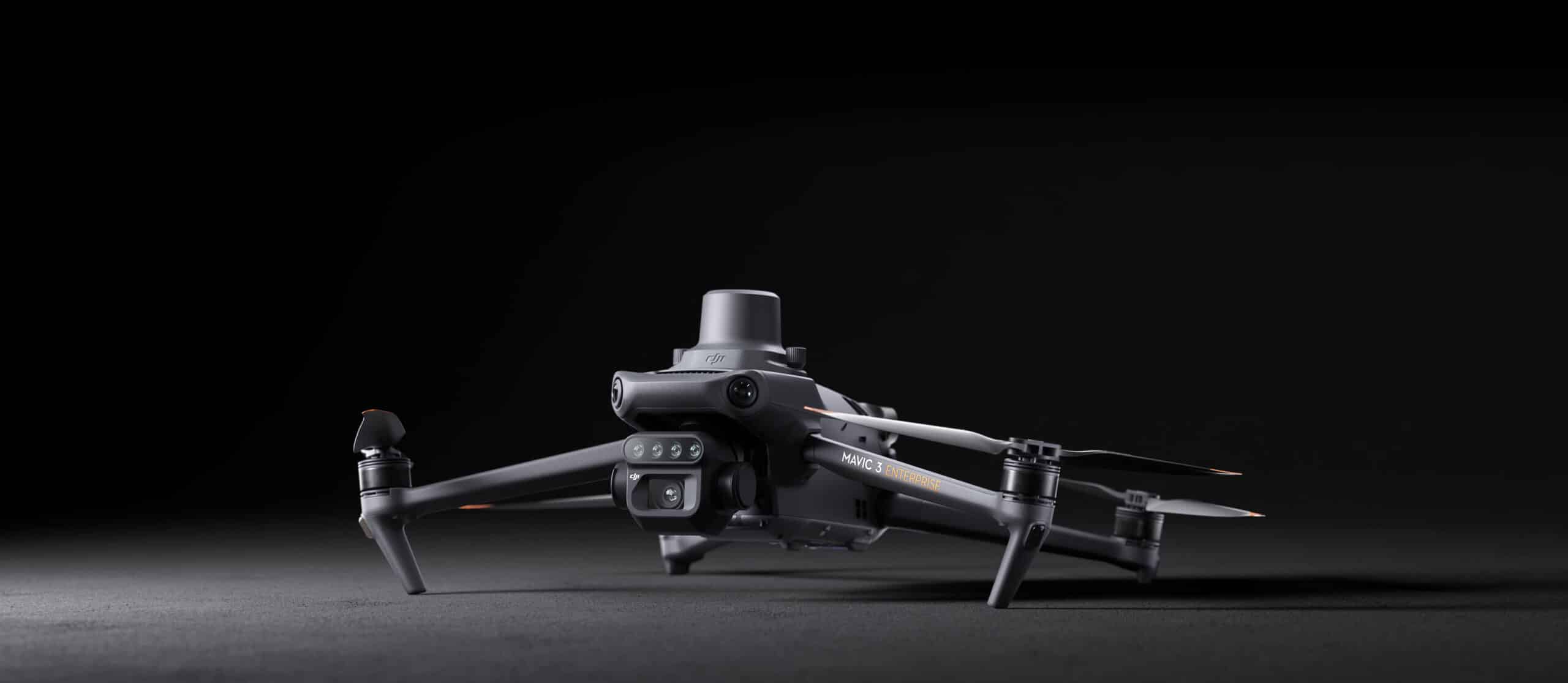
Effective aerial surveying needs to see the invisible. That’s why Mavic 3 Multispectral has two forms of sight. It combines an RGB camera with a multispectral camera to scan and analyze crop growth with total clarity. Agricultural production management requires precision and data, and Mavic 3M delivers both.
Omnidirectional Obstacle Avoidance
15km Transmission Distance
20 kg spraying tank, 16 L/min flow rate
25 kg spreading tank, 72 kg/min flow rate
Offline operations
2 km O3 Transmission
Optional DJI Relay
Up to 200 hectares per flight
Multispectral + RGB imaging system
Newly upgraded imaging system with one 20MP RGB camera and four 5MP multispectral cameras (green, red, red edge, and near infrared). Enables applications such as high-precision aerial surveying, crop growth monitoring, and natural resource surveys.
Mavic 3M allows terrain-follow aerial surveying of orchards, even on sloped landscapes. Together with DJI Terra or DJI SmartFarm Web to reconstruct high-resolution orchard maps, automatically identify the number of trees, distinguish trees from other obstacles or objects, and generate three-dimensional operation routes for agricultural drones, making operations safer and more efficient.
For rice fertilization, cotton growth regulation, and potato foliar fertilizer spraying, the Mavic 3M is used to obtain multi-spectral images of crops. DJI Terra or the DJI SmartFarm Web can then generate NDVI and other vegetation indices maps, capturing differences in crop potential and generating prescription maps that allow agricultural drones to execute variable-rate application. This ultimately allows users to reduce costs, increase yield, and protect the environment.
The Mavic 3M can carry out automatic field scouting. The field scout images can be uploaded to the DJI SmartFarm Web in real time through a 4G network. It can find abnormalities, such as emergence deficiencies, weed pressure, and crop lodging in a timely manner. It can also conduct intelligent analyses, such as cotton seedling identification and rice production testing, using AI identification for real-time sharing of crop growth information, guidance of agronomic activities, and easy management of 70 hectares of farmland by one person.
At AG Drones East, we’re dedicated to providing the highest quality Precision Ag Drone Aerial Application services, multispectral mapping, agricultural education, supplies, training, repairs, and value-added solutions to farmers and the communities we serve.