Call Us: 903-521-4170 | Email Us: [email protected]
Call Us: 903-521-4170
Email Us: [email protected]

DJI SmartFarm Web

The DJI SmartFarm can instantly generate high-definition images of farmland and orchards, as well as analyze crop growth with total clarity. It enables convenient management of digitalized agricultural information by providing guidance for the automatic operations of different agricultural machinery and monitoring the effectiveness of operations.

Intelligent Field Scouting and Analysis

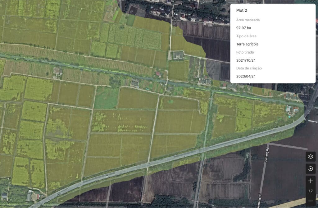
The platform can efficiently conduct field scouting by using aerial survey drones and can analyze the scouting images with AI algorithms. This allows automated monitoring of farmland and crops throughout the plant lifecycle, which significantly optimizes the decision-making process in agriculture.

Level Monitoring

Checks the terrain height differences of farmland and provides guidance on the level of each parcel of field.

Efficient Farmland Scouting

Monitors crop diseases and insect pests in farmland, implementing field scouting that is 100 times more efficient than conventional methods.

Growth Monitoring

Monitors crop growth to promptly discover differences in growth and enable targeted remedies.

Farmland Information Management

Farmland Information Management

Farmland Image Reconstruction

Instantly generates HD images of farmland

Farmland Planning

Automatically identifies farmland borders based on AI to obtain the area of each parcel of field.

Farmland Information Archiving

Records the operation information of each parcel of field to create farmland management archives.

Variable-Rate Operations Guidance

3D Route Generation